The Carters (my final NH48!)
When:
Saturday, Oct 22, 2022 8:45a -
4:45p
Saturday, Oct 22, 2022 8:45a -
4:45p
Where:
Alewife
Alewife(Cambridge, MA 02140, USA)
Cambridge, MA 02140
Admission:
Unknown
Hosted by:

Categories:
Meetup, Social Good, Sports & Active Life
Event website:
https://p.ridj-it.com/app/trip-detail?id=99205
The mountains, not Beyonce and Jay-Z. So no rap, but please join me for a wrap on the first huge chapter of my hiking endeavors!!
NOTE: This is not a beginner's hike. If we haven't hiked together before OR your Ridj-it profile is bare, please comment with some of your past experience before signing up for the trip. Also, we'll be on the teetering brink between fall and winter in the Whites, so please be prepared for wintry conditions! I'll be reporting back on the weather when we get closer, but it's probably safest not to sign up just yet at least if you don't have winter hiking experience.
Thanks!
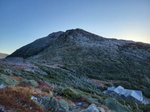
We will bag 3 NH48 peaks, Carter Dome, South Carter, and Middle Carter on this hike. We will take the steep Imp path up from Rt 16 to first hit Imp face cliff for some epic views! From there we will take North Carter trail to reach the ridgeline thus ending the largest chuck of climbing for the day. From there we will turn right heading South to first summit Middle Carter followed by South Carter. While both summits are wooded, there are pretty sweet lookout points with expansive views of the Wild River Wilderness and the Baldface Range on your left and the Presidentials on your right. From South Carter we will head down to the Zeta Pass followed by another moderate climb to Mt. Hight which will be more than made up for by the great 360 views from its bald summit. From there we will take the Carter Moriah trail to hit the highest and the last peak of the day, Carter Dome. While again being wooded there are also lookout point around Carter Dome with nice views of Carter Notch and the Wildcats, right across. We will continue down the Carter Moriah trail to Carter Notch and hike back out to Rt16 by the 19 mile brook trail.
**Note that we will need to do a bit of car spotting as there are 1.48 miles between the start and end of this route, or we can just walk back. Either is fine by me.
Length: 12.9 miles
Elevation gain: 4468 ft
difficulty: Hard
Gear:
Trail runners or hiking boots with good traction (NO SNEAKERS! you will be left behind at Alewife if you come in sneakers. )
Warm, non-cotton layers
Outer shell + hood for the rain/wind
2-3 liters of water
Warm hat and gloves
Microspikes
Snacks/ lunch
Trail map
First aid (ibuprofen, band aids, compression straps etc)
Highly recommended: hiking poles, electrolytes
Map:
Very excited for an excellent hike!! :)
-

SponsoredSMALL ⭐ MART Pride Market: Art, Makers & Vintage at Crystal Ballroom
Saturday, Jun 06, 2026 11:00a
Crystal Ballroom at Somerville Theatre
-

Sponsored -

Sponsored